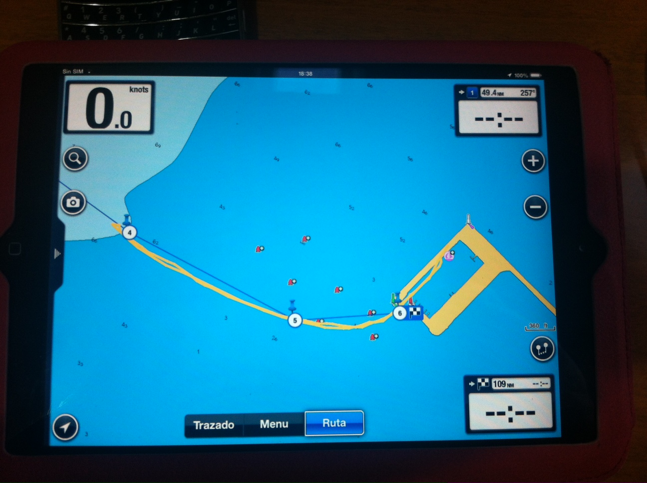
This graphic shows the tracks made in the author’s GPS, following the entrance channel in Campeche. One can notice the chart shows the bouys to the right of their actual position, so follow the instructions with the correct coordinates above to enter the harbour.
Campeche - Approach and charts
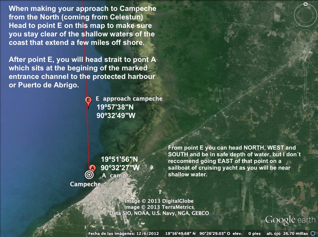
The City of Campeche faces the ocean on an area that was in the past part of the mangrove forest that still covers the shore north of the city. Therefore, the Bay of Campeche actually has no beach front and is very shallow for a few miles off shore. The depth can reach less than 2 feet in some areas and is no more than 4 in most of the zone that covers from the shore line and out to about 2 miles. From 2 miles out, the depth increases, but very gradually and still not much over 10 feet.
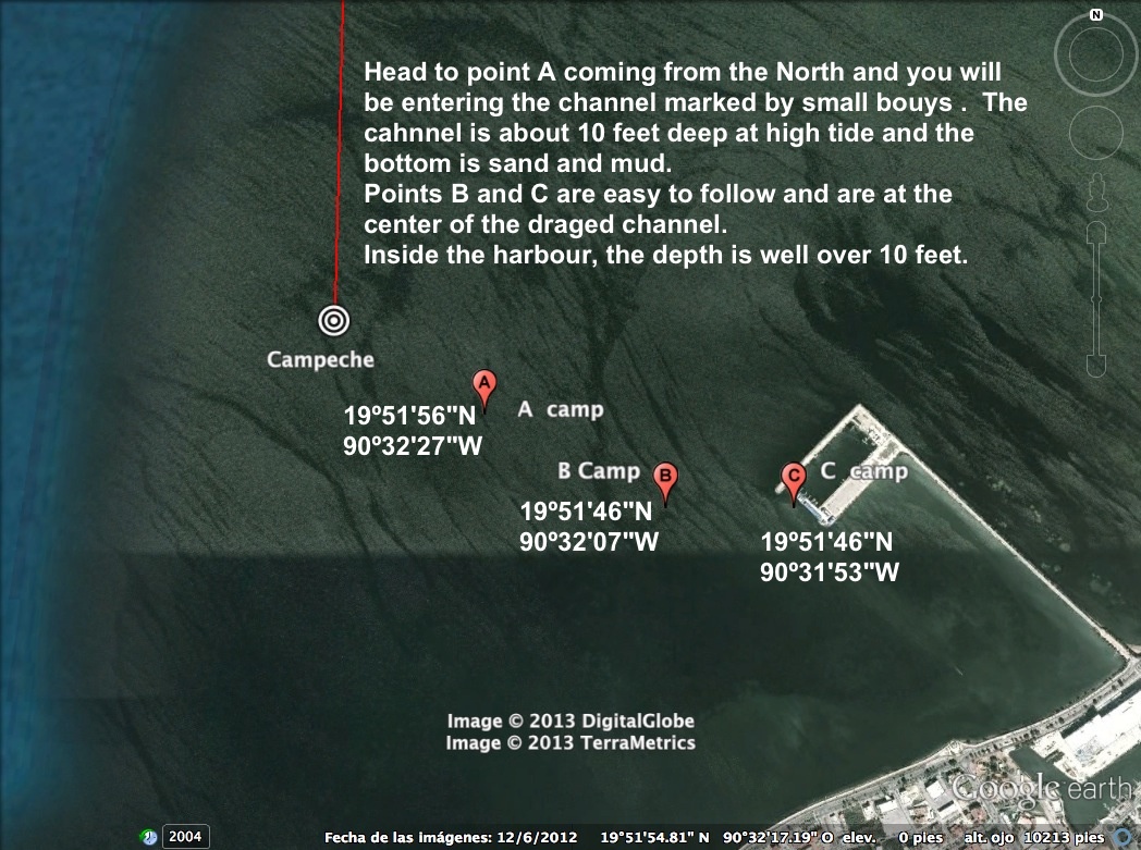
There are only a few dreged channels to reach the shore and the only one recommended for cruisers is the one that goes to the Touristic Harbour or Puerto de Abrigo, where cruisers can find 2 Marinas with basic services, but with good security and draft.
The dreged channel has sand and mud bottom as most of the coast line, and is dreged to about 10 feet on high tide. Tides in Campeche can vary a few feet from low to high, so I do recommend to check on the tides before headding into the channel, particularelly on a vessel that requires more than 7 feet.
Make sure you stay in the draged channel as the depth out side of it can be as low as 2 or 3 feet
For information on marinas and services in Campeche, go to Marinas and Services